|
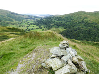
Troutbeck
Tongue
| Height: |
1,191 feet 363 metres |
|
| Ranking: |
207 |
| Grid Ref: |
NY 422 064 |
| Map: |
South-eastern Area |
| Book: |
Far Eastern Fells |
| DATE |
WALK |
DISTANCE |
ASCENT |
| Sunday, 6th August 2017 |
Ing Lane, Troutbeck Tongue, Park Fell, Thornthwaite Crag, Froswick, Ill Bell, Yoke, Garburn Road (Track), The Howe |
12 mls |
3,600 ft |
| Tuesday, 18th August 2015 |
Troutbeck Tongue, Park Fell, Froswick, Ill Bell, Yoke, Garburn Road (Track), The Howe |
10.5 mls |
2,900 ft |
| Tuesday, 18th August 2015 |
Troutbeck Tongue, Park Fell, Froswick, Ill Bell, Yoke, Garburn Road (Track), The Howe |
10.5 mls |
2,900 ft |
|
Sunday, 26th February
2012 |
Troutbeck Tongue, Low Mere Greave, Garburn Pass,
Sour Howes, Backstone Barrow, The
Howe |
10 mls |
2,350 ft |
|
Sunday, 25th April 2010 |
Troutbeck Bridge, Troutbeck Tongue,
Threshthwaite Mouth, Thornthwaite
Crag, Troutbeck Valley |
10.5 mls |
2,500 ft |
|
Sunday, 12th July 2009 |
Caudale Moor,
Threshthwaite Mouth,
Troutbeck Tongue, Troutbeck, Wansfell Pike,
Wansfell |
12.5 mls |
3,200 feet |
|
Sunday, 18th January 2008 |
Troutbeck, Long Green Head, The Tongue,
Troutbeck Park, Ing Bridge, Troutbeck |
7 mls |
1,350 ft |
| Sunday, 19th March 2006 |
Troutbeck Bridge, Garburn Road,
Sour Howes, Sallows,
Yoke, Ill Bell,
Froswick, Park Fell, Troutbeck Tongue, Ing Bridge |
11 miles |
3,300 feet |
Return to Wainwrights List
|