|
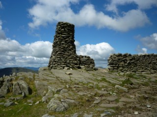
Thornthwaite
Crag
| Height: |
2,569 feet 783 metres |
 |
| Ranking: |
44 |
| Grid Ref: |
NY 431 100 |
| Map: |
North Eastern Area |
| Book: |
Far Eastern Fells |
| DATE |
WALK |
DISTANCE |
ASCENT |
| Thursday, 11th April 2019 |
Hayeswater Gill, Gray Crag, Thornthwaite Crag, High Street, The Knott, Satura Crag, Brock Crags, Hayeswater Gill |
9.5 mls |
2,800 ft |
| Sunday, 6th August 2017 |
Ing Lane, Troutbeck Tongue, Park Fell, Thornthwaite Crag, Froswick, Ill Bell, Yoke, Garburn Road (Track), The Howe |
12 mls |
3,600 ft |
| Wednesday, 3rd May 2017 |
Low Bridge, Shipman Knotts, Kentmere Pike, Harter Fell, Nan Bield Pass, Mardale Ill Bell, Thornthwaite Crag, Park Fell, Garburn Road (Track), Garburn Pass |
16 mls |
4,000 ft |
| Monday, 16th May 2016 |
Pasture Bottom. Threshthwaite Mouth, Thornthwaite Crag, High Street, Kidsty Pike, Rampsgill Head, The Knott, Hayeswater, Hayeswater Gill |
9 mls |
2,750 ft |
| Sunday, 12th August 2015 |
Gray Crag, Thornthwaite Crag, High Street, The Knott, Rest Dodd, The Nab, Satura Crag |
10.7 mls |
3,630 ft |
| Sunday, 1st June 2014 |
Hartsop Dodd, Stony Cove Pike, Threshthwaite Crag, Thornthwaite Crag, High Street, Kidsty Pike, Rampsgill Head, The Knott, Satura Crag, Brock Crags |
13 mls |
3,875 ft |
|
Wednesday, 7th August 2013 |
Hartsop, Gray Crag,
Thornthwaite Crag, High Street,
The Knott, Rest Dodd,
Brock Crags,
Angletarn Pikes, Boredale Hause, Hartsop |
12 mls |
3,530 ft |
|
Sunday, 19th May 2013 |
Kirkstone Pass Road, Broad End,
Stony Cove Pike, Thornthwaite Crag,
Froswick, Ill
Bell, Yoke, Garburn Road, Limefitt Park |
13.5 mls |
4,150 ft |
|
Thursday, 9th August 2012 |
Garburn Pass, Yoke,
Ill Bell,
Froswick, Thornthwaite Crag, High
Street, Mardale Ill Bell,
Nan Bield Pass, Kentmere valley |
12.5 mls |
3,000 ft |
|
Sunday, 30th May 2010 |
Hartsop, Gray
Crag, Thornthwaite Crag, High Street,
The Knott,
Rest Dodd, Brock Crags,
Angletarn Pikes, Boredale Hause |
10.7 mls |
3,630 ft |
|
Sunday, 25th April 2010 |
Troutbeck Bridge,
Troutbeck Tongue, Threshthwaite
Mouth, Thornthwaite Crag, Troutbeck Valley |
10.5 mls |
2,500 ft |
|
Sunday, 25th May 2008 |
Kentmere, Garburn Pass,
Yoke,
Ill Bell,
Froswick,
Thornthwaite Crag,
Mardale Ill Bell, Nan Bield Pass,
Harter Fell,
Kentmere Pike,
Shipman Knotts, Green Quarter |
13.5 mls |
3,400 ft |
|
Sunday, 11th May 2008 |
Kentmere, Garburn Pass,
Yoke,
Ill Bell,
Froswick,
Thornthwaite Crag,
Mardale Ill Bell, Nan Bield Pass,
Harter Fell,
Kentmere Pike,
Shipman Knotts, Green Quarter |
13.5 mls |
3,450 ft |
|
Sunday, 27th April 2008 |
Hartsop. Hayeswater Gill,
Gray Crag, Thornthwaite Crag,
High Street,
The
Knott, Satura Crag, Angletarn, Angletarn Pikes, Boredale Hause,
Hartsop |
10 miles |
3,200 ft |
|
Thursday, 24th April 2008 |
Hartsop. Hayeswater Gill,
Gray Crag, Thornthwaite Crag,
High Street,
The
Knott, Satura Crag, Angletarn, Angletarn Pikes, Boredale Hause,
Hartsop |
10 miles |
3,200 ft |
|
Sunday, 2nd April 2006 |
Patterdale, Hartsop,
Gray Crag, Thornthwaite Crag, Threshthwaite Mouth, Black Borrans, Hagg bridge, Ing Bridge, Troutbeck Church Bridge |
11 miles |
2,800 feet |
Return to Wainwrights List
|