|
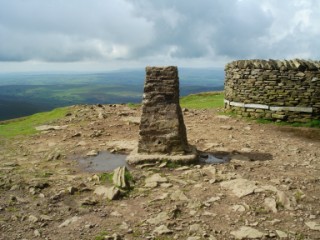
Pen-y-Ghent
| Height: |
2,278 feet |
 |
| Area: |
Ribblesdale |
| Grid Ref: |
SD 838 733 |
| Map: |
OS Explorer OL2 Yorkshire Dales S & W Areas |
| Type: |
Summit |
|
DATE |
WALK |
DISTANCE |
ASCENT |
TIME TAKEN |
| Monday, 15th June 2020 |
Brackenbottom Scar, Pennine Way, Pen-y-Ghent, Plover Hill, Foxup Moor, Hull Pot, Horton Scar |
9 mls |
1,810 ft |
5 hrs |
| Tuesday, 29th August 2017 |
Humphrey Bottom, Ingleborough, Sulber, Horton-in-Ribblesdale, Brackenbottom, Pen-y-Ghent, Pennine Way, High Birkwith, God's Bridge, Ribblehead, Blue Clay Ridge, Whernside, Philpin Lane, Low Sleights Road |
24.5 mls |
5,200 ft |
11.5 hrs |
| Sunday, 18th September 2016 |
Brackenbottom, Pen-y-Ghent, Plover Hill, Foxup Moor, Pen-y-Ghent Gill, Churn Milk Hole, Dub Cote |
14 mls |
2,600 ft |
6.5 hrs |
| Wednesday, 26th August 2015 |
Brackenbottom, Pen-y-Ghent, Horton Moor, Black Dubb Moss, Middle Pasture, Ribble Way, Pennine Way, Horton-in-Ribblesdale |
9.3 mls |
2,630 ft |
5.5 hrs |
|
Sunday, 18th August 2013 |
Brackenbottom Scar, Pen-y-Ghent, Plover
Hill, Foxup Moor, Pen-y-Ghent Gill, Blishmire House, Dub Cote |
14 mls |
3,000 ft |
6.75 hrs |
|
Sunday, 7th July 2013 |
Brackenbottom, Pen-y-Ghent, Plover Hill,
Foxup, Pen-y-Ghent Gill, Pennine Way, Brackenbottom |
14.6 mls |
2,750 ft |
7.5 hrs |
|
Sunday, 13th March 2011 |
Helwith Bridge, Long Lane,
Pen-y-Ghent, Pennine Way, Hull Pot,
Horton Moor, Horton-in-Ribblesdale, Ribble Way |
9.5 mls |
2,256 ft |
5.75 hrs |
|
Tuesday, 11th January 2011 |
Brackenbottom, Pen-y-Ghent, Plover Hill,
Foxup Moor, Hull Pot, Horton Scar |
8.5 mls |
1,800 ft |
4.5 hrs |
|
Sunday, 16th
November 2008 |
Horton Bridge, Brackenbottom,
Pen-y-Ghent, Plover Hill, Foxup Moor, Hull Pot |
9.3 mls |
2,000 ft |
5 hrs |
|
Wednesday, 17th
September 2008 |
Horton-in-Ribblesdale, Ribble Way,
Helwith Bridge, Pen-y-Ghent, Pennine Way, |
8.5 mls |
1,400 ft |
5 hrs |
|
Sunday, 21st January 2007 |
B6479, Horton Bridge, Pen-y-ghent,
Plover Hill, Foxup Moor, Horton Moor, Horton Scar, B6479 |
12.5 mls |
1,500 ft |
- |
Return to Other
Summits List
|