Sunday, 15th November 2009
| Walk: | Langcliffe, Catrigg Force, Stainforth, Stainforth Force, Smearsett Scar, Feizor Scar, Giggleswick Scar | ||
| Start Point: | Langcliffe car park | Grid Ref: | SD 823 651 |
| Distance: | 12 miles | Ascent: | 2,050 feet |
| Weather: | Mainly dry with a little sun | ||
| Accompanied by: |
On my own |
||
| Comments: | Having previously walked in this area I decided to return and adapt the route so that I could use it for a group walk. Setting out from Langcliffe, where there is a free car park, I headed up to Catrigg Force. With all the rain we have been having it was putting on quite a show. Rather that take the direct path to Stainforth I made my way through pasture which turned out to be rather muddy in places, but more interesting than the alternative. Passing through Stainforth (where there are public toilets) I diverted from the route to visit Stainforth Force - a good spot for elevenses. A short road walk soon gave way to an enclosed green track which eventually allowed access to Smearsett Scar. After visiting the trig point I made my way along the ridge, past Pot Scar and onto the limestone pavement at the end of the ridge. From here I had to head north to join the track leading into Feizor which is a tiny hamlet of just a few houses - and a cafe. I then took the path signposted to Stackhouse but left this at a junction of paths to head across to Giggleswick Scar. After descending past the quarry it was necessary to head north again so that I could cross the River Ribble before turning south to Langcliffe. A very enjoyable walk with only a few muddy sections in the mainly dry, green terrain. | ||
Scroll down to see photos of the walk

With no leaves on the trees much more of the woodland is seen as I head for . . .

Catrigg Force . . .

and experiment with the camera to photograph the movement of the water . . .

and try out different angles . . .

plus one as I leave
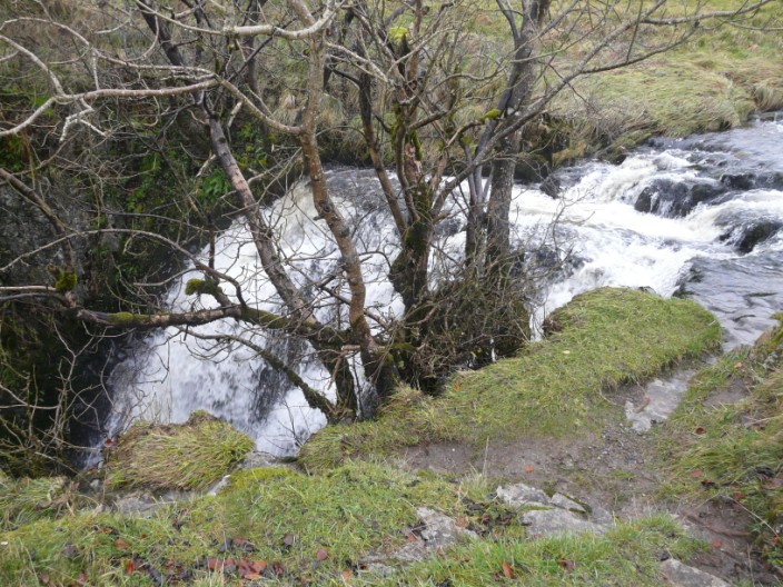
Stainforth Beck becomes Catrigg Force

We've all got our eyes on you!

Stainforth Force - shame about the photographers . . .

so I'll go for a shot a little upstream - and include the bridge

While eating lunch on the banks of the beck . . .

I decided to experiment . . .

zooming in on the top of the Force

A green lane heads up to Hargreaves Barn - but it's wetter than it looks

Pen-y-Ghent hides in clouds, from the slopes of Smearsett Scar

The sun peeps out for a shot on Smearsett Scar . . .

but it's quite windy up here . . .

and it's even sunnier looking along the ridge to Pot Scar . . .
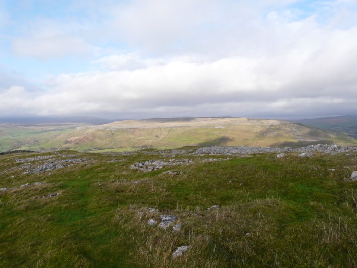
and across the valley to Moughton Scar

The rocky top of Pot Scar . . .

and limestone pavement overlooks Feizor Wood

An unusual garden (water) feature

Pot Scar in the centre and Smearsett Scar to the right, from the path to . . .

Giggleswick Scar

Looking down the Ribble Valley, Settle can just be seen

You can do a little cave exploration en route . . .

but I'll just zoom in on it today

There is still a little Autumn colour around

The weir on the River Ribblw

War memorial in Langcliffe . . .

and the village green
Return to 2009 Diary Return to top