|
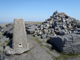
Great Whernside
| Height: |
2,310 feet |
 |
| Area: |
Wharfedale |
| Grid Ref: |
SE 002 739 |
| Map: |
OS Explorer OL30 Yorkshire Dales N and C Areas |
| Type: |
Summit |
|
DATE |
WALK |
DISTANCE |
ASCENT |
TIME TAKEN |
| Sunday, 18th February 2018 |
Dowber Gill Beck, Providence Pot, Hag Dyke, Great Whernside, Blackfell Top, Tor Dike, Starbotton Road, Starbotton, River Wharfe, Dales Way |
10.5 mls |
2,200 ft |
6 hrs |
| Friday, 26th January 2018 |
Dales Way, Providence Pot, Hag Dyke, Great Whernside, Blackfell Crags, Tor Dike, Starbotton Road, Starbotton, River Wharfe, Moor End |
10.5 mls |
2,700 ft |
6 hrs |
| Tuesday, 26th September 2017 |
Dowber Gill Beck, Providence Pot, Hag Dyke, Great Whernside, Blackfell Crags, Black Dike, Starbotton Road, Starbotton Cam Road, Starbotton, Moor End, New Bridge |
11 mls |
2,500 ft |
6 hrs |
|
Tuesday, 19th June 2012 |
Blackfell Crags, Great Whernside, Sweet
Hill, Hill End, Highgate Leys Lane (Track), Dales Way, Kettlewell,
Moor End, Starbotton, Starbotton Cam Road, Starbotton Road |
13 mls |
2,640 ft |
6.5 hrs |
|
Thursday, 24th May 2012 |
Kettlewell, Hag Dyke, Great Whernside,
Nidd Head, Hem Gill Shaw, Starbotton Road, Starbotton, Dales Way,
Kettlewell |
11.8 mls |
2,100 ft |
6 hrs |
|
Sunday, 20th July 2008 |
Great Whernside - Dowber Gill Beck, Providence Pot,
Hag Dyke, Great Whernside, Hunters Sleets, Starbotton, returning to
Kettlewell via Dales Way |
11.5 mls |
2,220 ft |
6.5 hrs |
Return to Other
Summits List
|