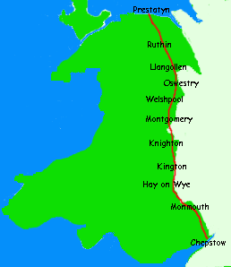
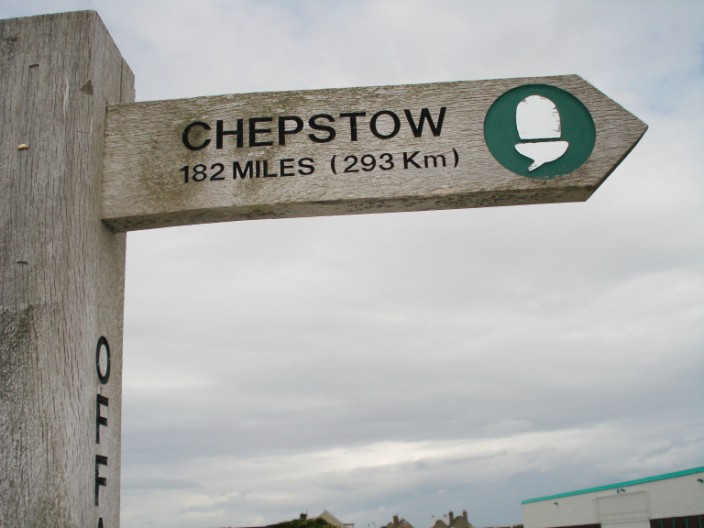
198 miles
21/06/07 to 02/07/07
Having completed Wainwright's Coast to Coast walk the previous year, we decided to do a Welsh 'coast to coast', better known as Offa's Dyke Long Distance Path. With the accommodation booked and luggage transport arrangements made we headed off to Chepstow for the beginning of the walk. We were very impressed with the efficiency of the train service and the cost - just £10, booked well in advance. It will be noted that I have included the statistics for the number of stiles - we counted these as we had read that there were numerous stiles on this walk! Also included are the nicknames given to each day, depending on weather, terrain, stiles, etc.
* * * * * * * * * * * * * * * * * * * * * * * * * *
If you wish to move quickly to a particular day please select from below:
[Day 1 - Chepstow to Monmouth]
[Day 4 - Hay-on-Wye to Kington]
[Day 6 - Knighton to Brompton Crossroads]
[Day 7 - Brompton Crossroads to Buttington Bridge]
[Day 8 - Buttington to Llanymynech]
[Day 9 - Llanymynech to Chirk]
[Day 11 - Llandegla to Bodfari]
[Day 12 - Bodfari to Prestatyn]
* * * * * * * * * * * * * * * * * * * * * * * * * *
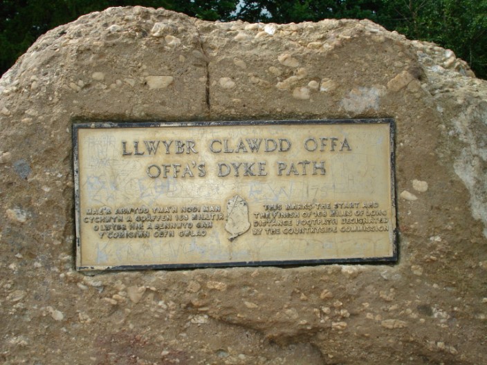
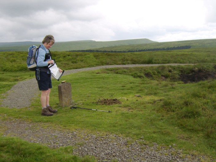
The stone marking the beginning/end of the walk on the cliffs above the River Severn
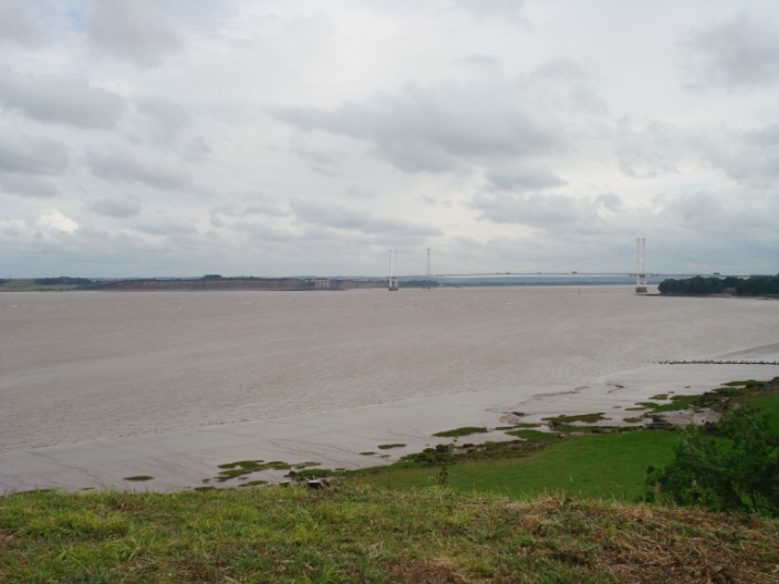
Severn Estuary and Severn Bridge (M48)
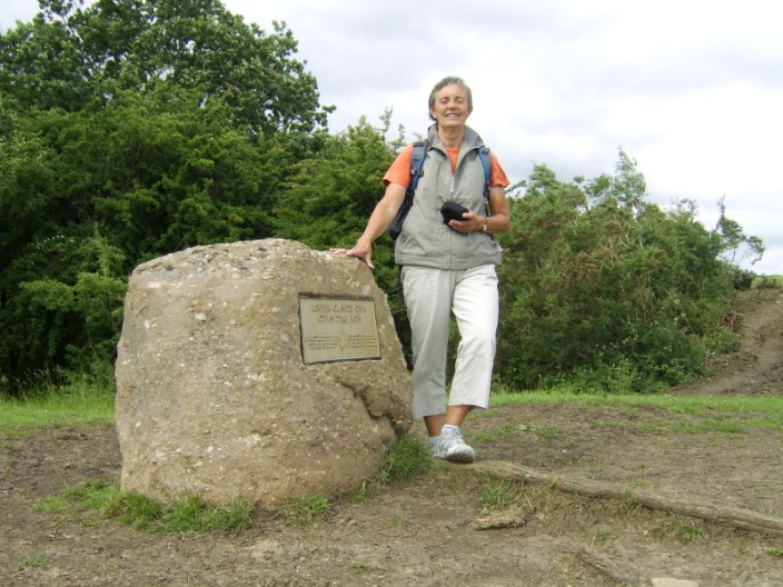
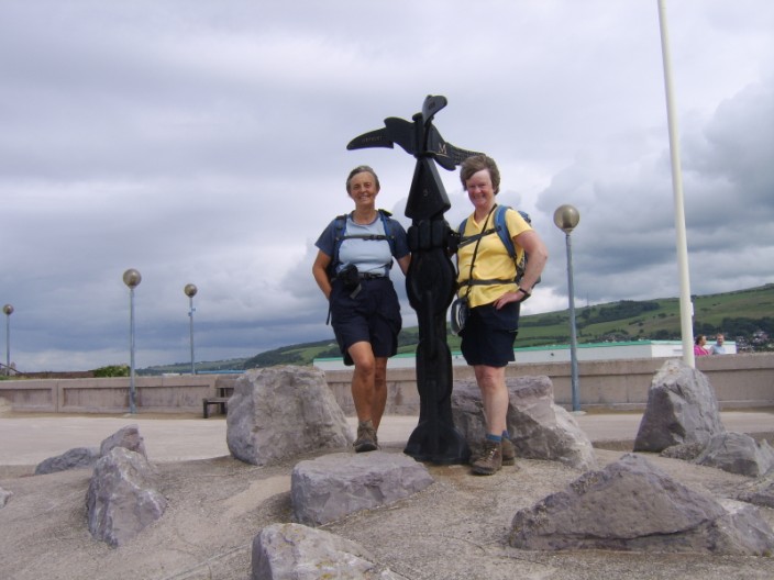
Marie is ready to set off . . .
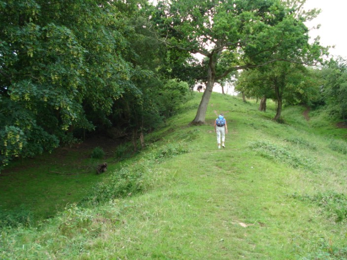
and heads along the first section of the dyke
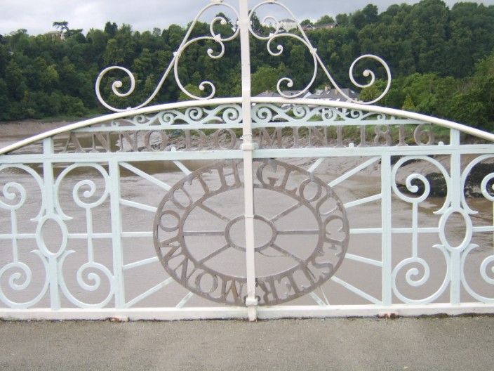
Rennie's Bridge over the River Severn, half in Monmouth and half in Gloucester
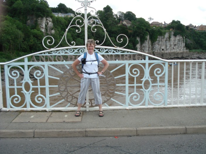
A foot in each county
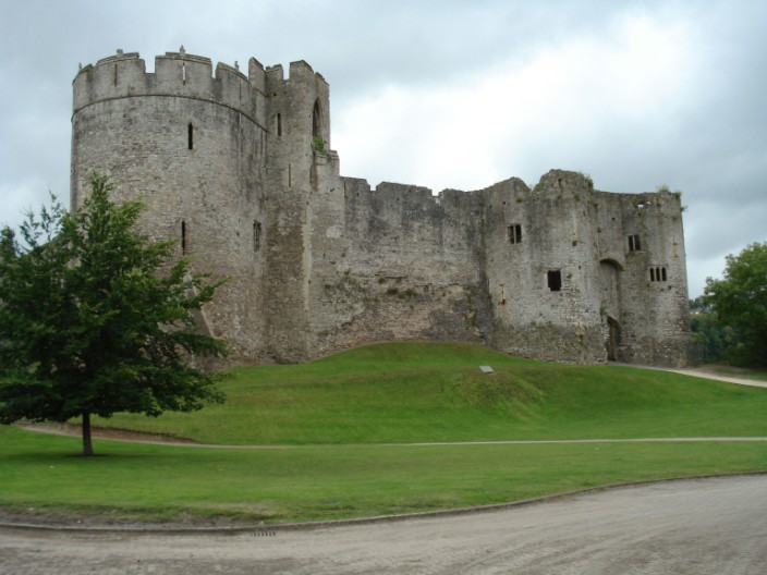
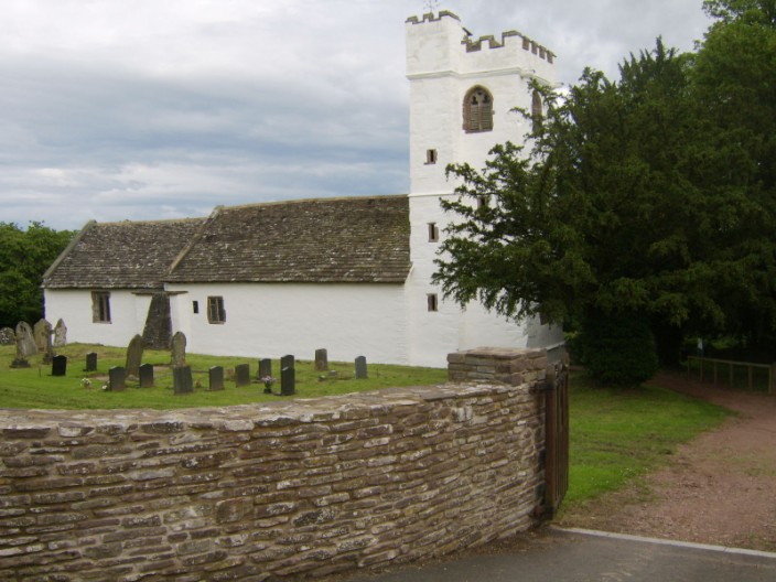
Chepstow Castle
* * * * * * * * * * * * * * * * * * * * * * * * * *
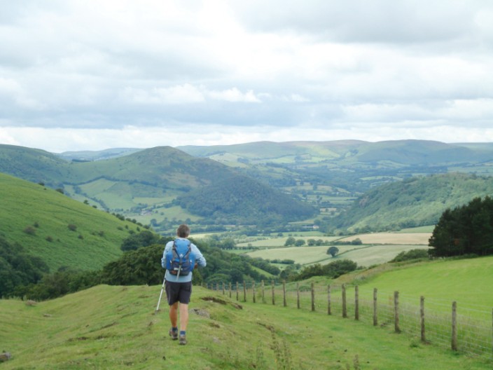
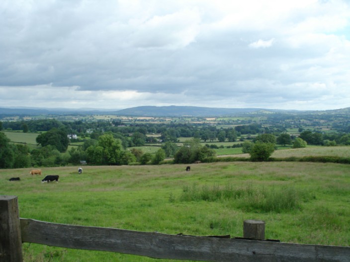
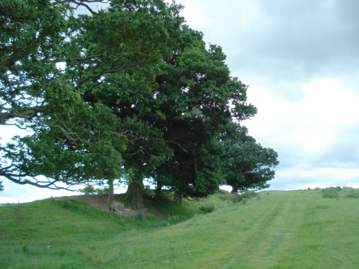
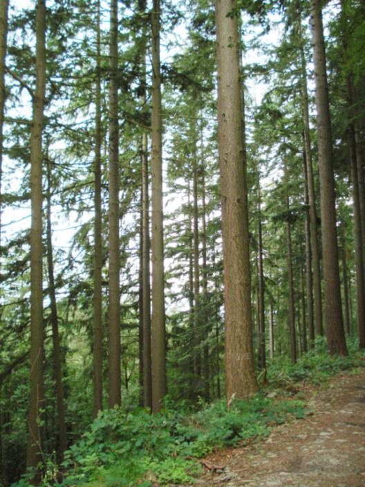
Day 1 - The Woodiest: Chepstow to Monmouth, 18 miles, 28 stiles
Setting out on a dull but dry day we were impressed at the thoughtfulness of a
local resident who had provided 'refreshments' for walkers. Making our way through the
woodland section above the River Wye we soon came across the outlook, known as The Devil's
Pulpit, where we could see down to Tintern Abbey. Legend has it that Old Nick preached to
corrupt the monks of Tintern from this point. After walking
through woodland and fields we eventually reached the Naval Temple and the
Round House on the slopes of The Kymin. The Round House was built in 1794 by
'The Gentlemen of the Kymin Club', a late 18th century dining club.
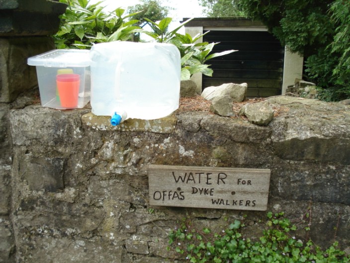
Thoughtful residents leave out refreshments (water) which would be welcome on a hot day
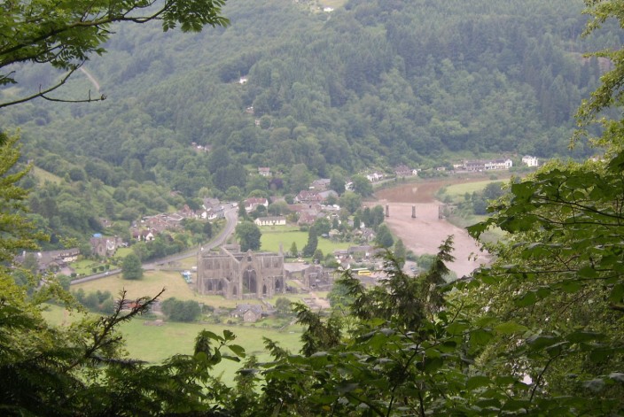
Tintern Abbey from The Devil's Pulpit
Heading down to Redbrook
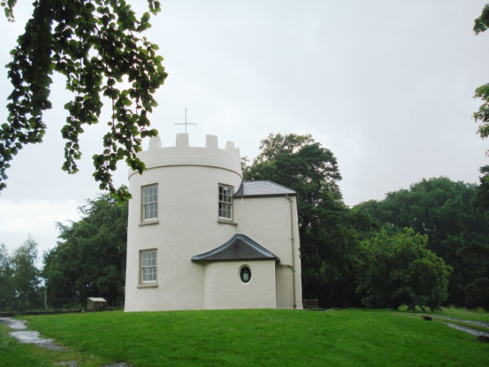
The Round House on The Kymin
* * * * * * * * * * * * * * * * * * * * * * * * * *
Day 2 - The Muddiest: Monmouth to Pandy, 19.7 miles, 64 stiles
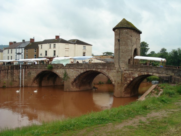
We left Monmouth by way of the old bridge with a gatehouse built in the 13th century.
Unfortunately there was a Farmer's Market on the bridge so we weren't able to
fully appreciate the architecture. With very muddy and overgrown paths and a
couple of showers we were pleased to find shelter in the porch of an isolated
medieval church, St Michael's of the Fiery Meteor, for elevenses. Navigating
through an extensive orchard was not easy but we eventually made it and
found a stone wall at a road bridge to stop for lunch - not an ideal spot but
the best on offer! Many more muddy fields and some road walking later we reached
Pandy where we were staying at a B & B that used to be a pub. Fortunately the
owners provided an evening meal - there was nowhere else within a couple of
miles!
The old bridge out of Monmouth - plus the Farmers' Market
A bright stretch on a dull day
The grass is always greener on the other side!
Mother and daughter take a good look at us - the stile is just behind Mother!
St Cadoc's Church, dating from the 13th century, at Llangattock-lingoed
* * * * * * * * * * * * * * * * * * * * * * * * * *
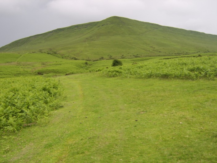
Day 3 - The Highest: Pandy to Hay-on-Wye, 17.3 mls, 14 stiles
Shortly after leaving the B & B we began the climb to the Hatterall Ridge which
is on the Black Mountains, mainly along the border of England and Wales. Along
the ridge is the highest point of the whole walk but it was difficult to
pinpoint its exact location. Being on higher ground the path was much better
than those we has experienced thus far and any boggy parts had been upgraded
with flagstones. After descending from the ridge we crossed a very long common and a sunken lane that was
more like a river, we descended to Hay-on-Wye through a field filled with wild
orchids, a beautiful sight.
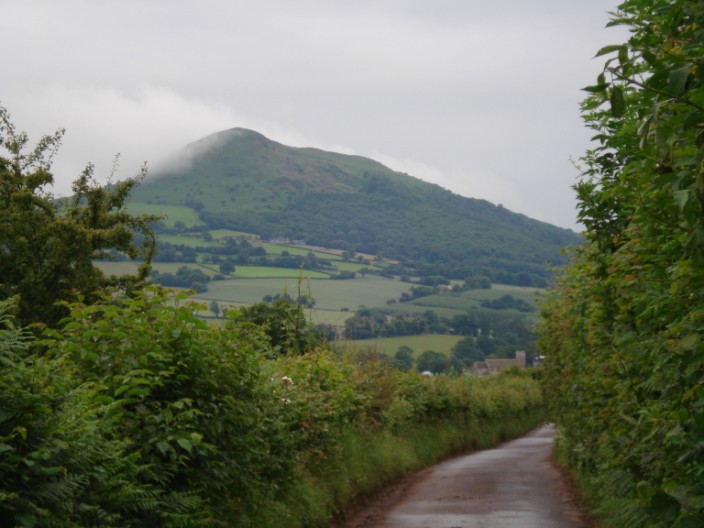
The Skirrid
Looking back along Hatterall Ridge
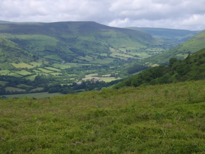
Olchon Valley - one of the many good views from the ridge
Turning to the next page in the guide book
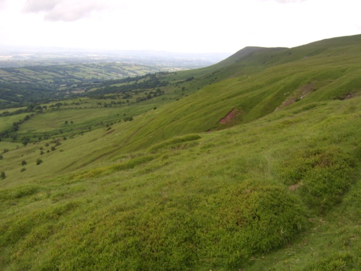
Hatterall Hill
Hay-on-Wye - the 'Capital' of second-hand books
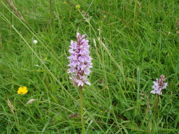
Heath Spotted Orchid - in a meadow filled with wildflowers
* * * * * * * * * * * * * * * * * * * * * * * * * *
Day 4 - The Wettest: Hay-on-Wye to Kington, 16.8 mls, 4 stiles
With a forecast of heavy rain we decided to invest in a couple of umbrellas and
they were certainly needed, though a little difficult to control in the strong
winds! There were a
number of road sections on this section of the walk but for once we didn't mind
as it meant that walking was easier than ploughing through muddy fields and wet
overgrown paths. As we arrived in Newchurch we wondered where we would be able
to have our elevenses - at nearly 2pm. As we passed the church we spotted a sign
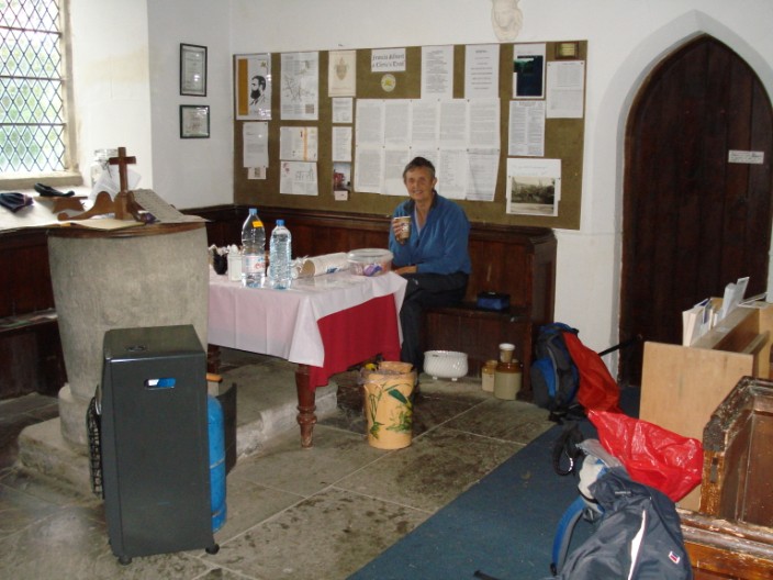
welcoming walkers to enter and partake of the refreshments - for a small donation. This was such a welcome refuge
from the weather that we could hardly believe the thoughtfulness of someone in
the church. They had set up water, kettle, milk, tea, coffee and biscuits.
It gave us a chance to take off the wet waterproofs and enjoy a good rest. After
another 3 or 4 miles we arrived at Gladestry - and another church that welcomed
Offas Dyke walkers. Here we had our lunch and were able to continue the walk
quite refreshed. We then headed off to the highlight of the day, the Hergest
Ridge. This was easy walking on a wide grassy path, a welcome relief from muddy
paths.

St Mary's Church at Newchurch . . .
with a warm welcome for Offa's Dyke walkers
Hergest Ridge
Playing hide and seek on Hergest Ridge
First or last?
Depends which way you view the sign!
* * * * * * * * * * * * * * * * * * * * * * * * * *
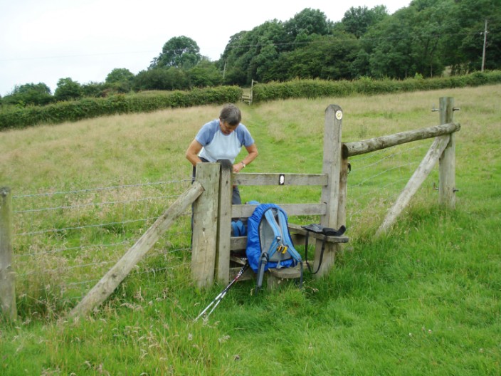
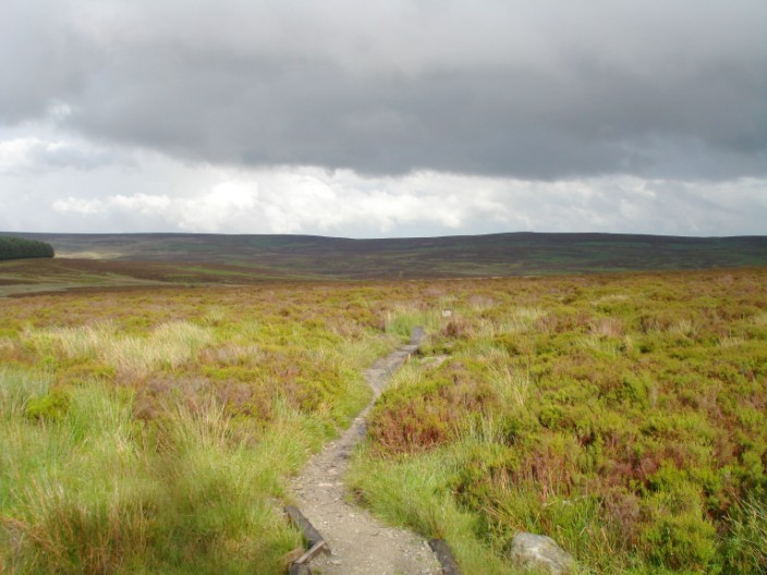
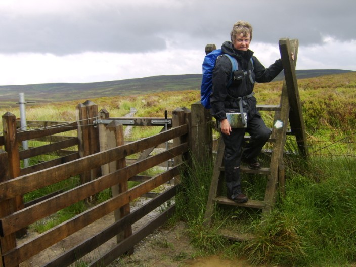
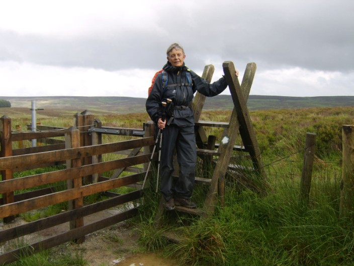
Day 5 - Most Stilish: Kington to Knighton, 14.6 mls, 81 stiles
After climbing onto Bradnor Hill, we passed Kington Golf Club, the highest golf course
in England. We followed a good section of the dyke and found the spot shown on
p.111 of the guide book, descending Rushock Hill - cameras out! The rest of the day consisted of some ups and downs with decent paths,
and welcome sunshine to enjoy at our 'refreshment' stops. We arrived in
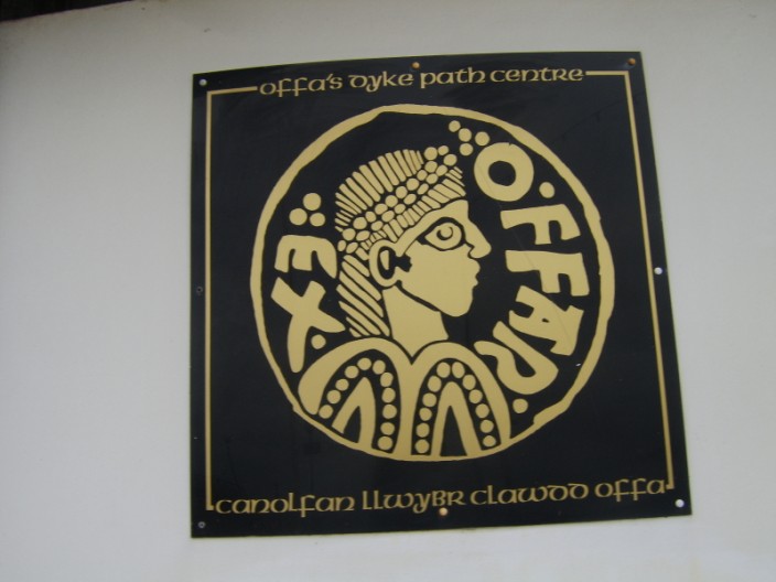
Knighton in time to have a look at the Offa's Dyke Centre though the information
and gifts did seem a little sparse. The town itself looked a
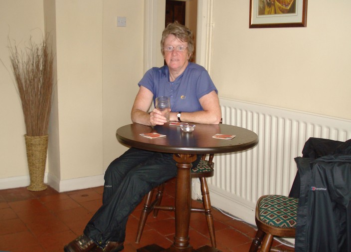
bit 'down at heel'. When we returned to the George and Dragon we were pleasantly
surprised to find that the accommodation was in a converted stable block at the
back of the pub. This was very tastefully decorated and furnished to a high
standard.
A pause for a look back at Knighton
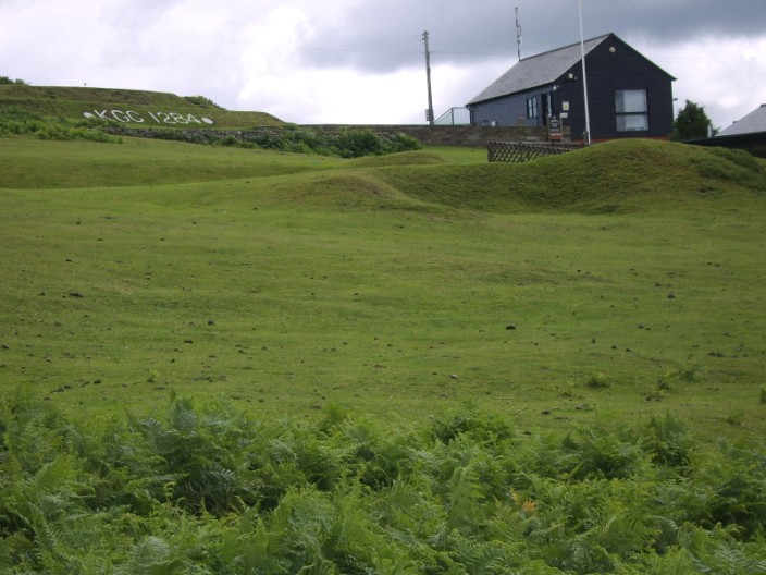
The highest golf course in England - at 1,284 ft
A clear section of dyke running alongside the fence . . .

and in the opposite direction
Recreating the picture from the guide book . . .
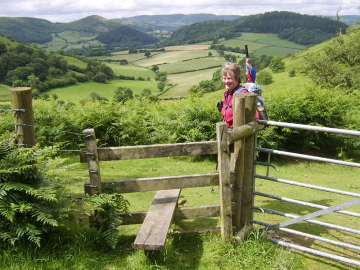
before we utilise the stile for our morning break
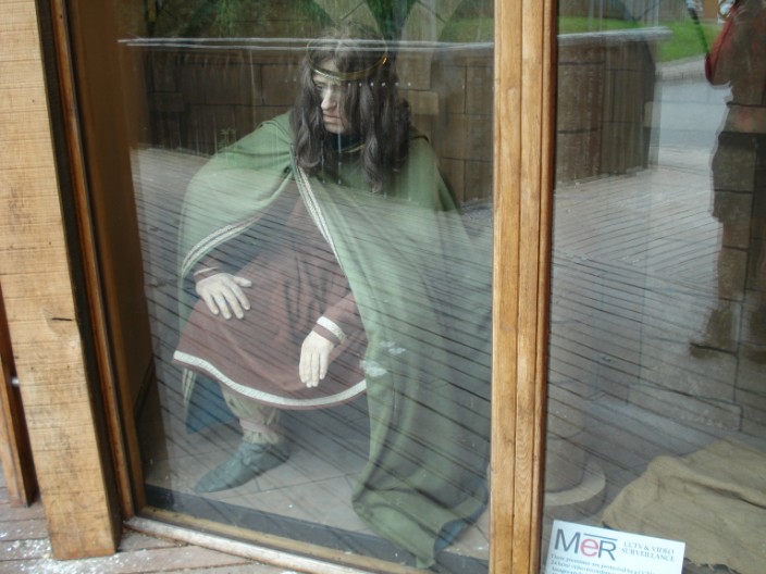
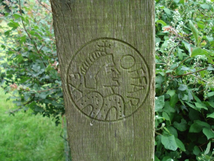
King Offa at the Offa's Dyke Centre in Knighton
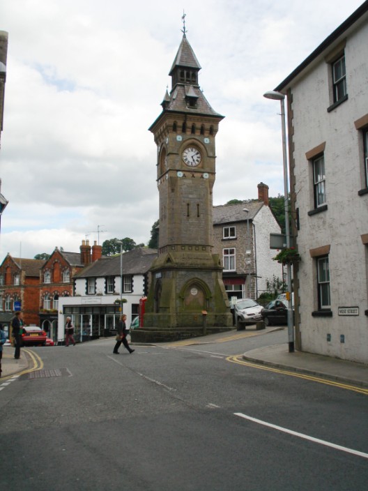
Knighton clock tower
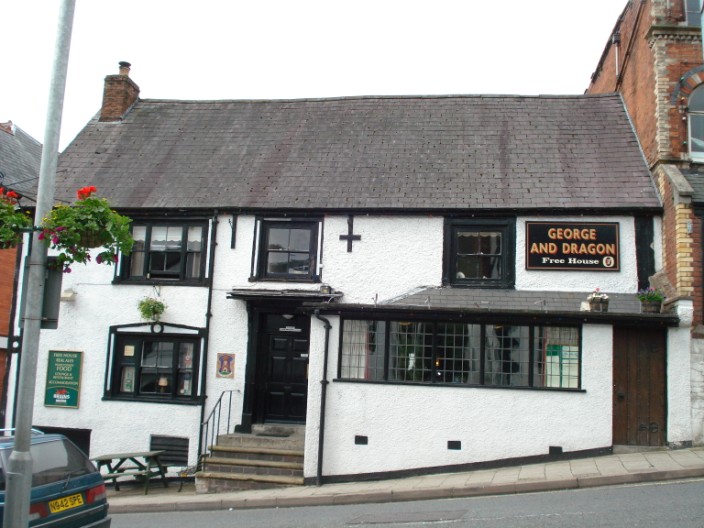
A great place to stay
* * * * * * * * * * * * * * * * * * * * * * * * * *
Day 6 - Most Undulating: Knighton to Brompton Crossroads, 14 mls, 62 stiles
The guidebook states that today's section is the toughest part of the route,
consisting of a long procession of short steep climbs and descents known as 'The
Switchback'. We found it a welcome relief to the mainly low level walking
we had done thus far. Llanfair Hill is considered to be the best bit of the dyke
and is also
the highest point where the path is actually on the dyke. When an Offa's Dyke
Association 'AGM Walk' was led along here by Lord Hunt the queue
stretched from one stile to another. Continuing on our route we eventually reached The Drewin,
our accommodation for the night. We were made to feel
very welcome with a drink and freshly baked chocolate cake. With no hostelries
within 5 miles the hostess booked
us in for an evening meal at a pub in Bishop's Castle, and even provided
transport to and from the venue.
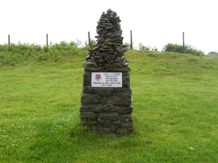
The memorial stone which commemorates the opening of the route by Lord Hunt
Llanfair Hill - the highest and best part of the route - the path follows the line of trees in the distance
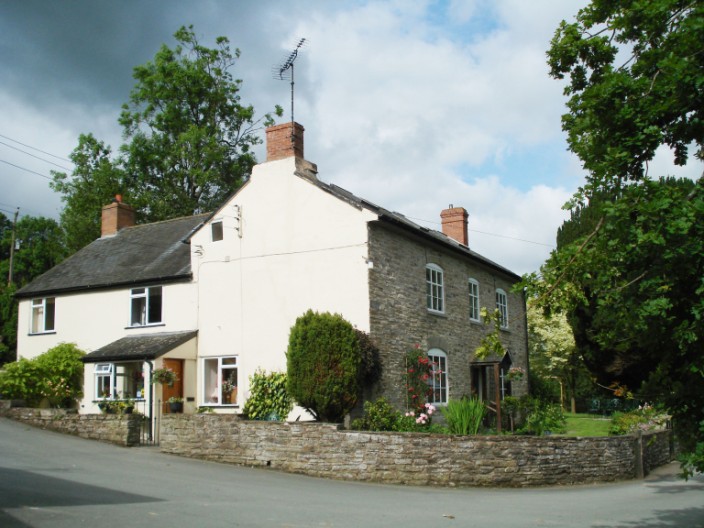
The Drewin - our B & B, a typical old farmhouse with lots of character . . .
and a great view
* * * * * * * * * * * * * * * * * * * * * * * * * *
Day 7 - The Strangest: Brompton Crossroads to Buttington Bridge,15mls, 75
stiles
Following a very enjoyable breakfast we soon reached the grounds of Mellington
Hall where the 'stick man' was waiting for us - time for a photoshoot!
After leaving the
grounds via the gatehouse the paths were overgrown with weeds on one side and crops on the other,
making walking difficult. With very wet ground underfoot Marie decided to try
out the latest fashion in footwear - the plastic bag look! (see the
photographs) It was difficult to find a suitable place for lunch so an area of
cleared forest had to suffice. At least we were not short of seats! With the B & B
0.75 miles off route along a busy main road we were looking forward to a
comfortable room, etc. Unfortunately this was not what we found. The B & B was by far the
worst on the route and not to be recommended.
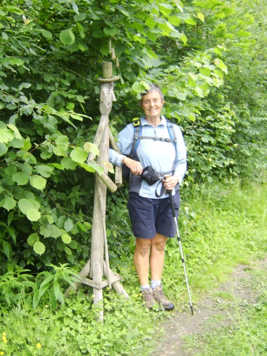
Mr Stickman finds a friend . . .
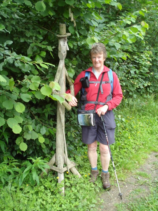
and another one
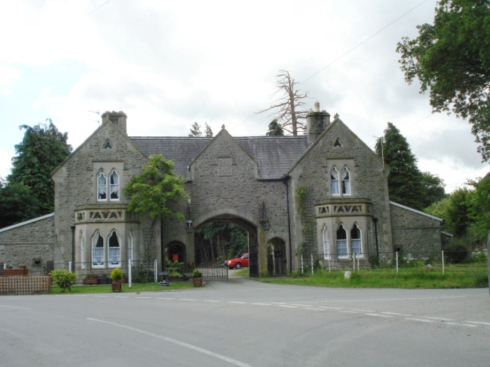
The gatehouse at Mellington Hall, a mansion built in 1876 and now a hotel
Trees on the dyke near Montgomery
The new fashion in footwear
The symbol on many stiles in this area
At this point only the tree canopy is green . . .
but a little further on we see quite a different picture
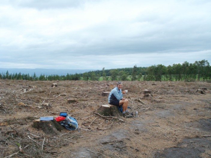
Not the most picturesque lunch spot - but a wide variety of seats to choose from
Follow me!
* * * * * * * * * * * * * * * * * * * * * * * * * *
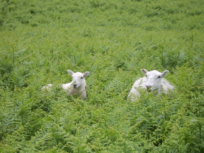
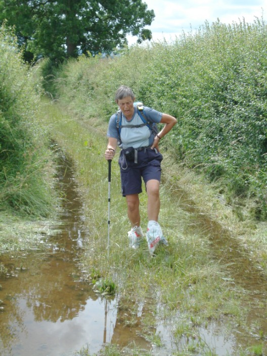
Day 8 - The Flattest: Buttington to Llanymynech, 10.7 mls, 42 stiles
As the next part of the path was by the River Severn we thought there might be
some problems underfoot. However, we were in for a surprise - and not a very
pleasant one. Due to the building of a new embankment the path had been
diverted. It was extremely muddy and difficult, with awkward
stiles to cross and to tmake matters worse it was raining - umbrellas to the fore!
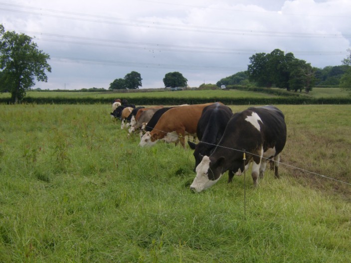
After this hazard had been navigated another one was waiting for us - a
congregation of cows around the stile. A little 'cow talk' did the trick and we
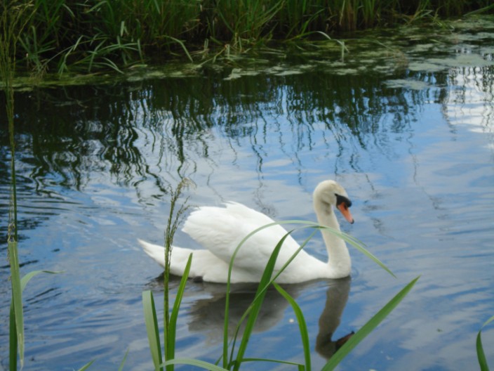
were soon able to continue. Along the canal path we passed two swans who were so
busy preening themselves that they took no notice of us, and a group on a 'family
outing'. Next we came across a pair with two cygnets, who were ready to attack
anyone who came close to them. We beat a hasty retreat and shortly afterwards
arrived at the B & B with time to do a little shopping.
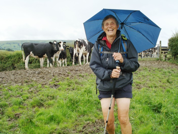
Rolled up shorts and umbrellas are the order of the day
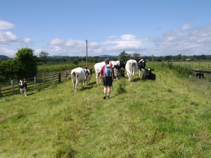
Some more cows on the path that need a little 'talking to'
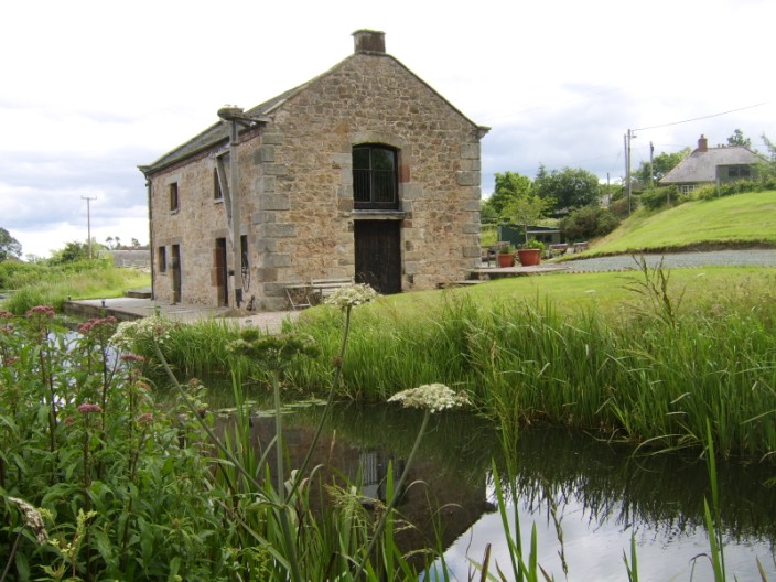
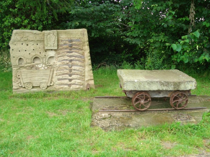
Signs of past industry on the canal
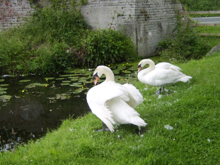
Don't bother us!
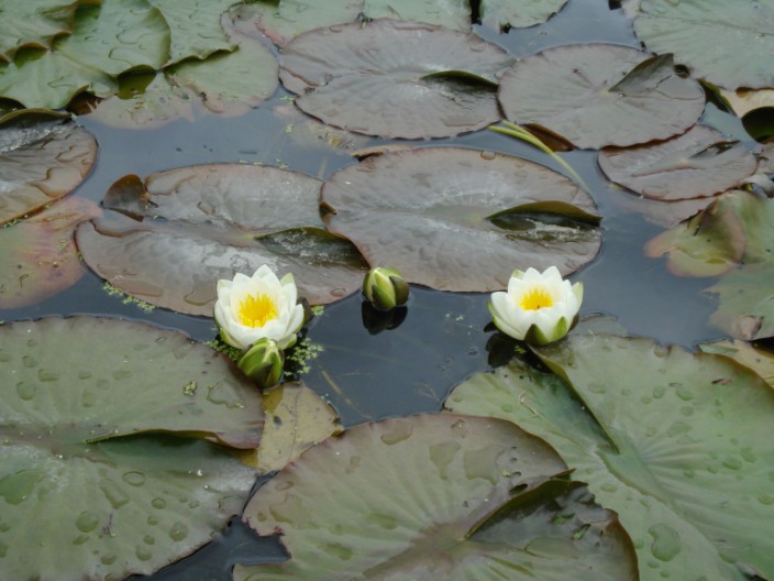
White water-lily
Tollhouse at Carreghofa
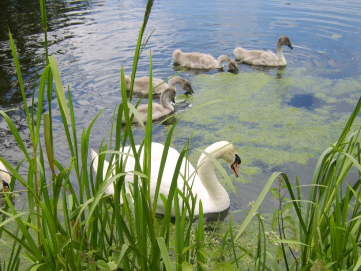
Family outing . . .
playing 'follow-the-leader'
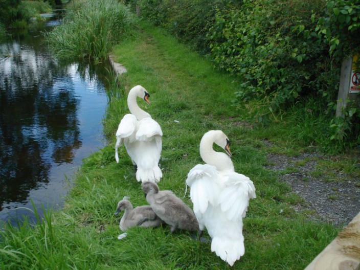
Very protective parents
* * * * * * * * * * * * * * * * * * * * * * * * * *
Day 9 - The Weariest: Llanymynech to Chirk, 18 mls, 66 stiles
The forecast was for a wet day and by the time we reached Trefonen we were ready
to find some shelter. Fortunately there was a pub where we had a room all to
ourselves - another group having just left as we entered. What's more,
the room had a stone floor so it didn't matter that we were leaving puddles
everywhere! Suitably refreshed (no we didn't have any alcoholic drinks!),
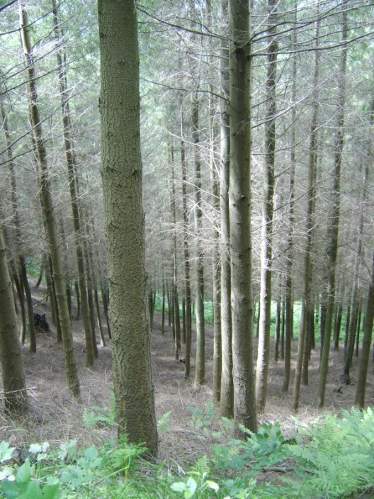
we continued on our way - through woods where the path was very rough with lots of
tree roots waiting to trip us up. As we were
approaching the descent to Chirk we met a couple who warned us that the next
section of the path was down a very steep and muddy path then up a similar path
at the other side. They took us on a detour which added about half a mile to our
day. On checking the book later, it stated that 80 steps and a fine footbridge
had been put in place by the Royal Engineers and Shropshire County Council to
make this deep ravine passable. Pity we hadn't noted this earlier!
A stile seat for elevenses before the deluge
Drying out . . .
but we can't stay here all day!
Canal and viaduct on the way into Chirk
* * * * * * * * * * * * * * * * * * * * * * * * * *
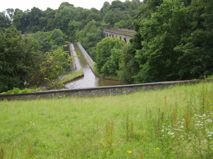
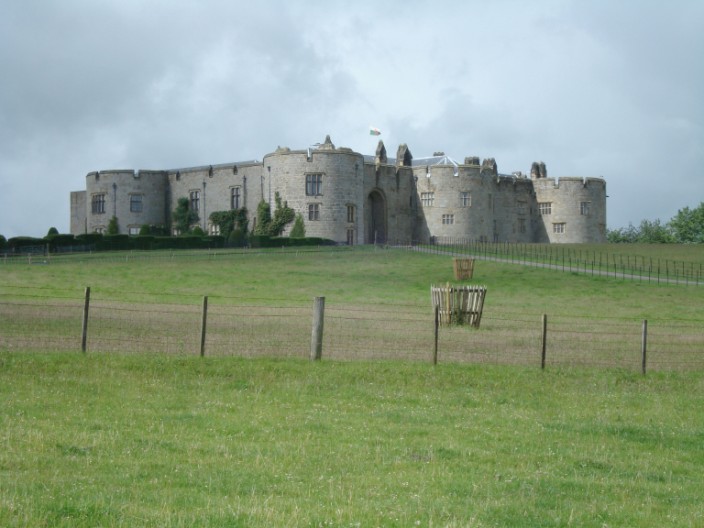
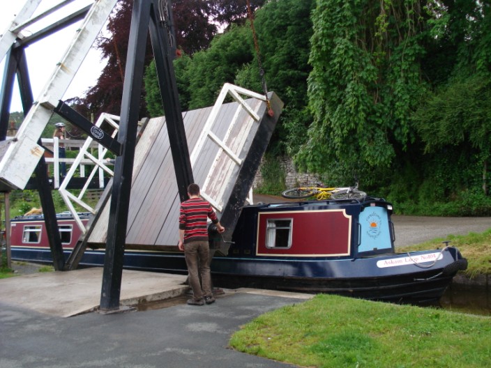
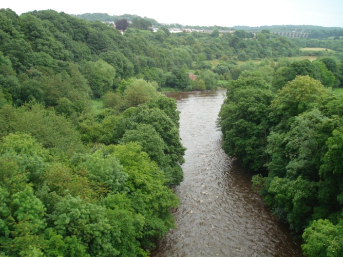
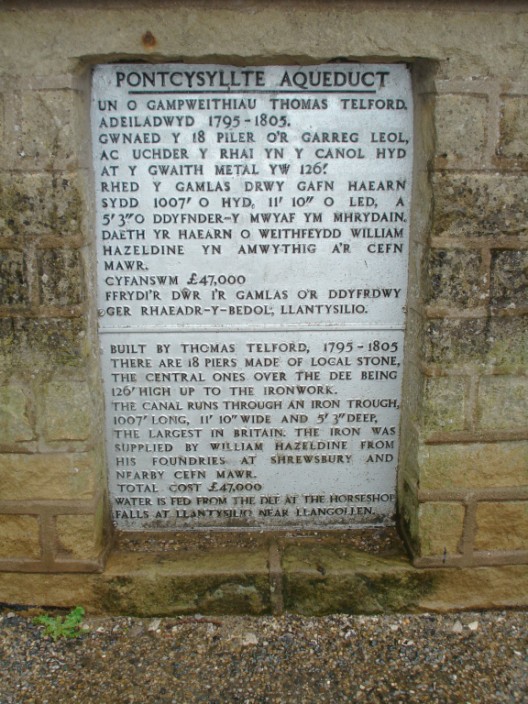
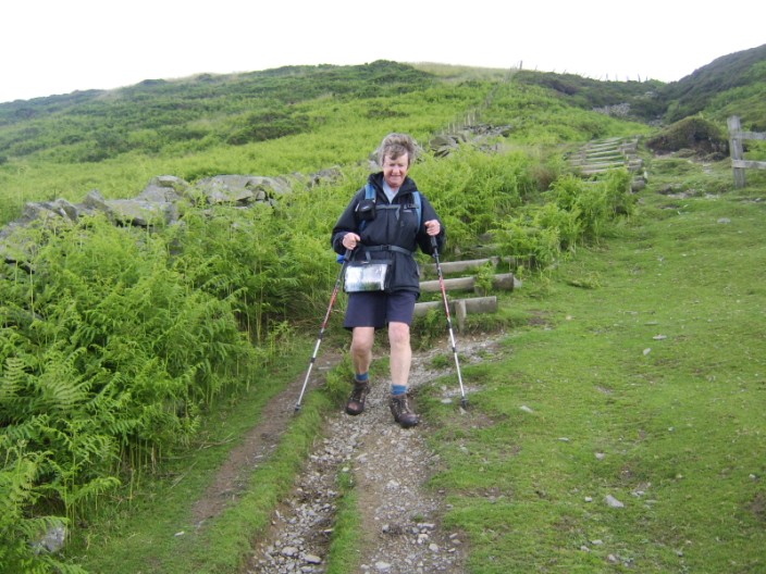
Day 10 - The Longest: Chirk to Llandegla, 17 mls, 9 stiles
Making our way back to the route we passed Chirk Castle which has been
continuously inhabited since 1310. It now belongs to the National Trust and is
open in Spring and Summer. The superb wrought iron gates were made in 1712-19.
On the Llangollen Canal we passed (or were passed by) a number of narrowboats
and were fortunate enough to see the swing bridge in action. Crossing the
aqueduct was a great experience -with a 120 foot drop.
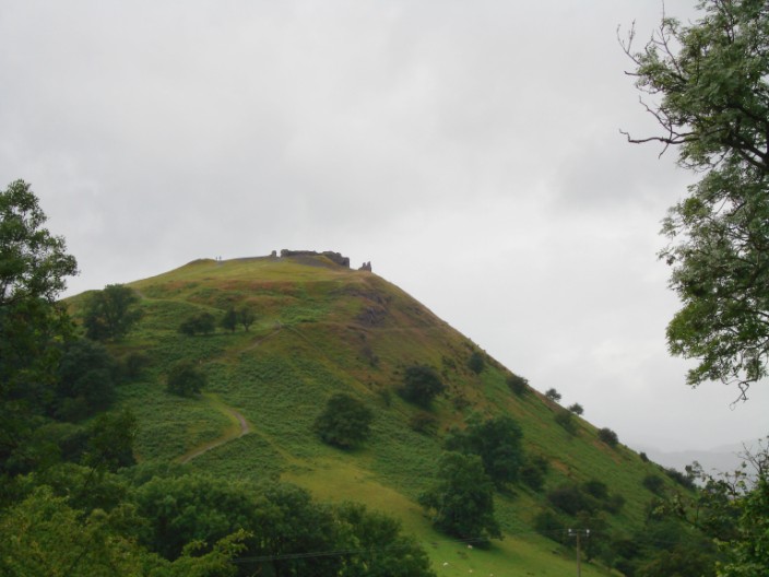
This was one of the highlights of the walk. After traversing the Panorama walk
we could see Castell Dinas Bran, a simple Welsh castle probably constructed in
the 13th century. Where the official path led onto the scree slopes
we decided to take the road option heading for World's End (the name of a farm
at the head of the valley). From there it was up onto the moors, across a
boardwalk section and through the forest to a main road where there was a handy
restaurant where we had dinner before being picked up by the owners - a
service provided as they are a couple of miles off the route.
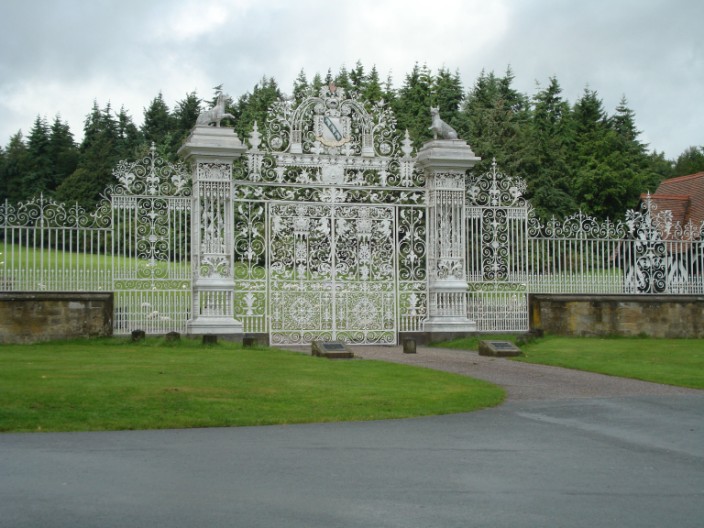
The impressive entrance to Chirk Castle
The high sandstone walls and massive drum towers have changed little but the inside has been restored and converted into a stately home
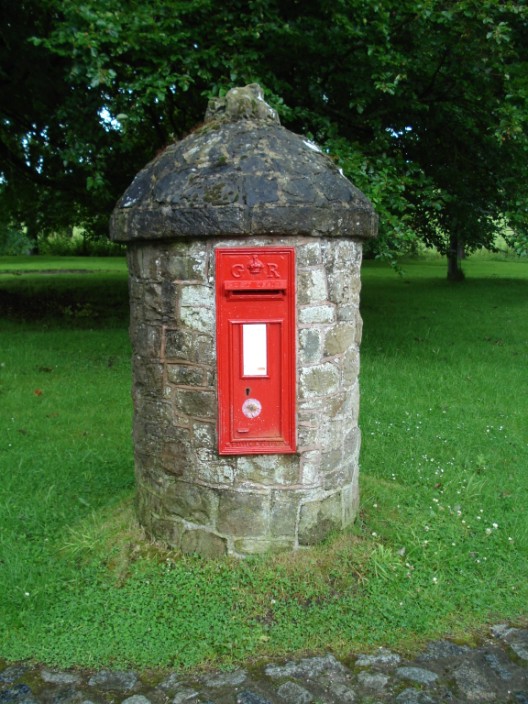
The postbox in the grounds of Chirk Castle
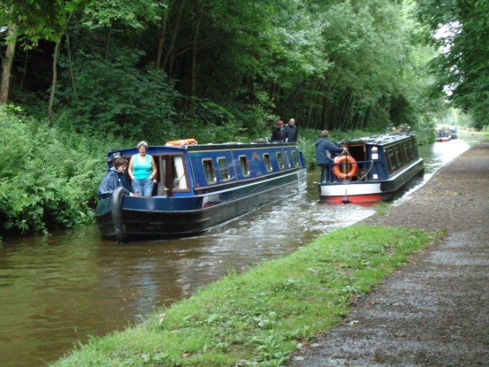
Narrowboats on the Llangollen Canal
What timing!
Reminders of the past
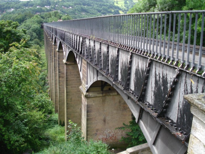
The huge arches on the aqueduct . . .
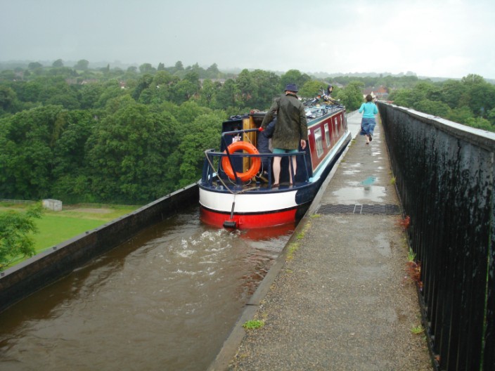
One way of getting to the front of the narrowboat - jump off, run and jump back on
From the aqueduct looking East to the railway viaduct . . .
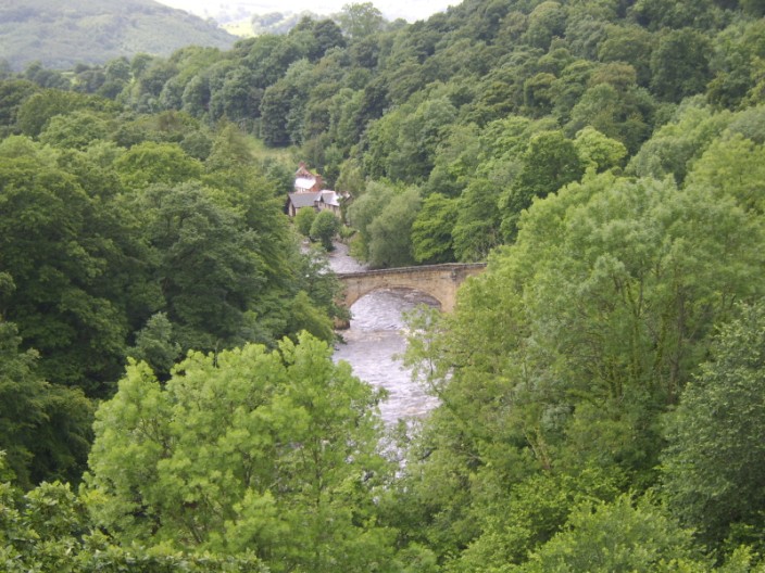
and looking West to the road bridge
Speaks for itself
Castell Dinas Bran
The moorland path
Finally leaving the moorland . . .
which we are glad to see the back of
* * * * * * * * * * * * * * * * * * * * * * * * * *
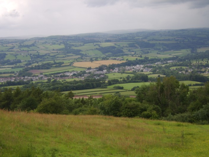
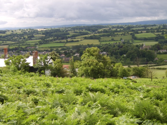
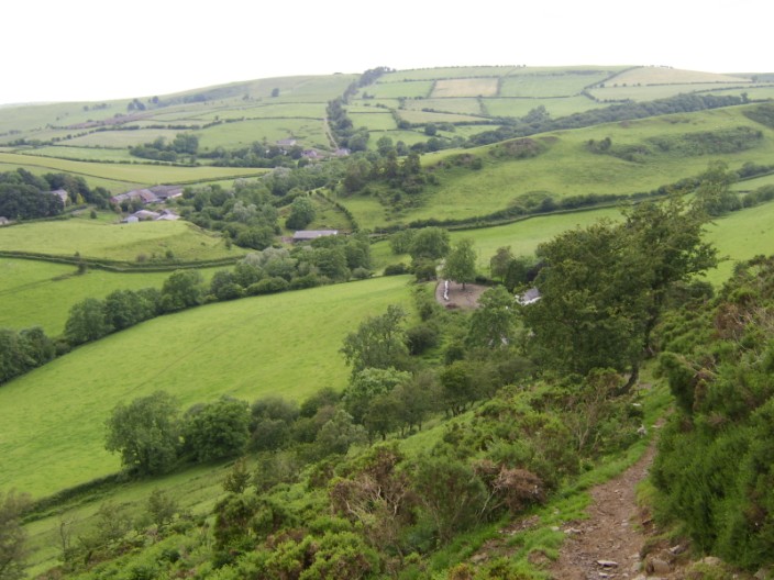
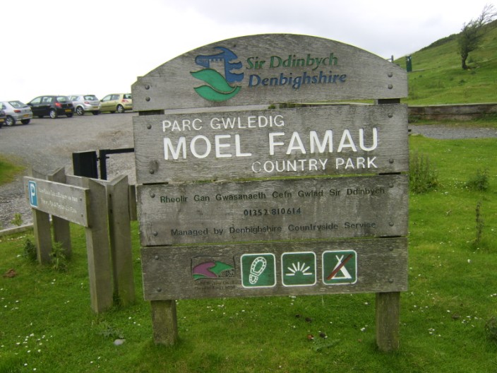
Day 11 - The Hilliest: Llandegla to Bodfari, 20 mls, 51
stiles
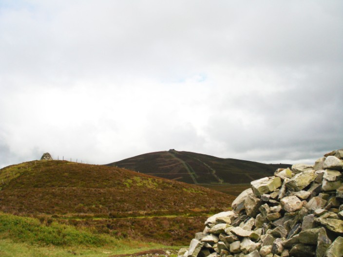
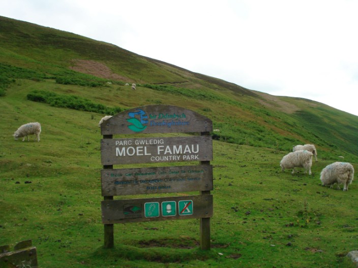
After about 3 miles through fields we began to climb the Clwydian mountains,
most of which we skirted rather than going over the top. In Moel Ffamau Country
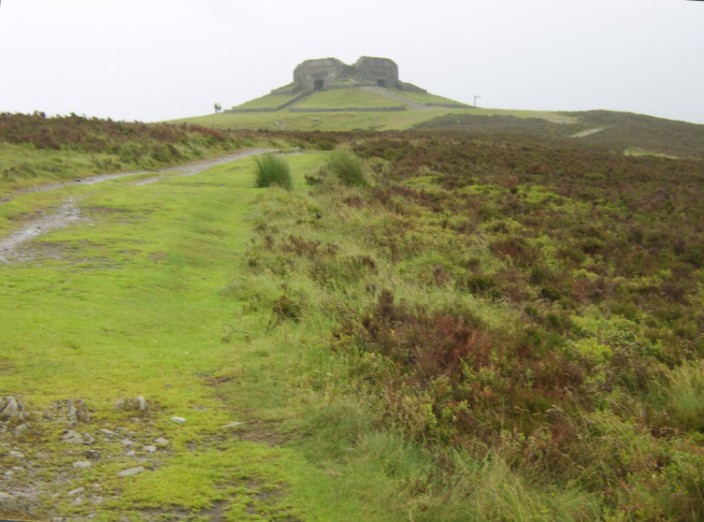
Park we made our way to Jubilee Tower
which was, after a sudden heavy downpour, covered in mist. The Tower was erected in 1810 to mark the
Jubilee of George III but it was never completed. It partly collapsed because of
insubstantial foundations but was tidied up in 1970. Further along the route we passed
small groups of teenagers, possibly Duke of Edinburgh Award candidates. At one
point, a girl who was a little behind her group sat down and said 'I want to go
home NOW!' I think we have all known that feeling at some time! A few (or lots
of) miles later we reached our B & B, the most expensive en route and worth every penny. The room was very comfortable and everything was of very good
quality. There was a huge bathroom next door, for our sole use, with a raised
deck next to the bath, a big shower and a bidet. We enjoyed a long soak in the
bath after what had been a very long day.
Ruthin was in view for much of the day
Two minutes after this photo the heavens opened . . .
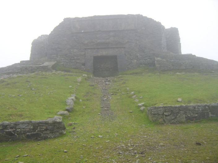
leaving Jubilee Tower in mist . . .
which, inevitably cleared as we continued on
Looking back to Jubilee Tower . . .
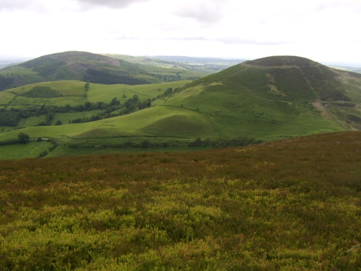
and on to Moel Arthur
Descending from the Clwydian Hills . . .
we reach the end of the country park
* * * * * * * * * * * * * * * * * * * * * * * * * *
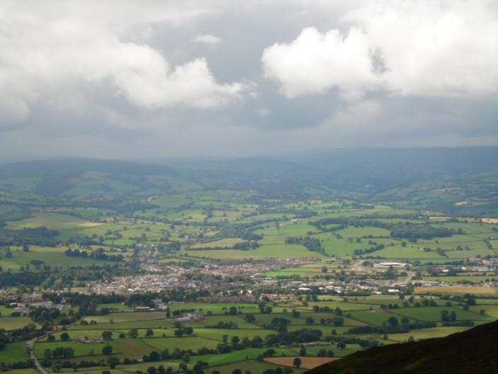
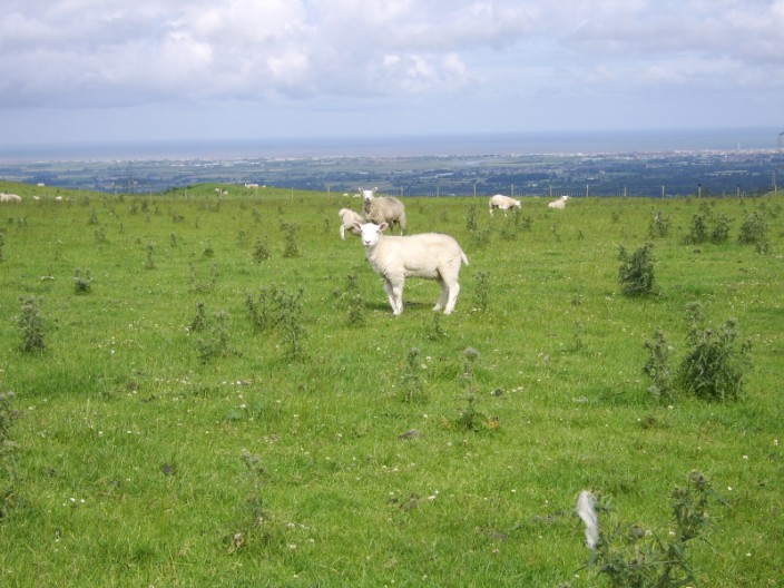
Day 12 - The Last: Bodfari to Prestatyn, 13 mls, 58
stiles
There
were some ascents and descents along the route but it was quite uneventful until
we reached a derelict farm called Maen Efa. Eventually finding the stile covered
in and surrounded by bracken and nettles we made our way into the farmyard via a
rickety gate. However, with no path to continue along we eventually had to
retrace our steps and find an alternative route! This section of the route really needs checking out. After crossing Marian Ffrith we came to
what must have been the worst section on the whole path. We had to cross a track
that ran between two hedgerows and fences. It was impossible to cross without
sinking ankle deep in mud. Fortunately shortly afterwards
we came across a water trough where we were able to clean a lot of the mud off
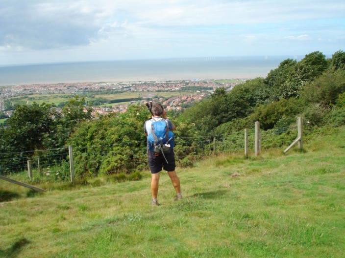
our boots. Finally, at around 3pm, we
had our first view of the sea. The cliff path was rather tedious and involved more
climbing than we expected. However the route down was quite gradual and not bad
going. The final section was then straight ahead to the beach where we found
the appropriate signs and carried out the mandatory 'boot dipping ceremony'. We
then had the luxury of being driven back home - thanks to Lynda and Mike.
Our first glimpse of the sea . . .
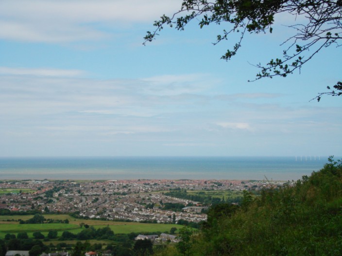
shortly afterwards Prestatyn comes into view . . .
Marie makes the most of the photo opportunity
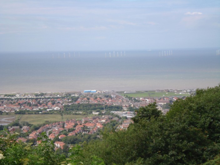
Close enough to see the wind farm
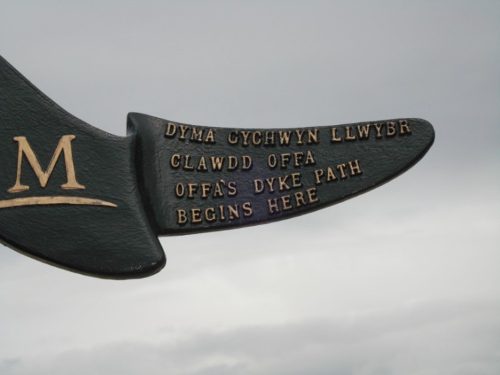
The end - or is it the beginning?
We made it!
King Offa has a lot to answer for
We were there - but I don't think we'll go back just now!
* * * * * * * * * * * * * * * * * * * * * * * * * *